Hiking: Trout Pond | Catskill Mountains, NY | May 25, 2013
If you are in the western Catskills near the villages of Roscoe, Livingston Manor or Liberty, a great day hike, especially if you have children is the trip to Trout Pond from Russell Brook Road. This trail follows a well maintained old road and slowly climbs from Russell Brook to Trout Pond. The southern shore of Trout Pond has a small beach area and at the northern end of the pond are two lean-tos that you can camp at. In addition to the lean-tos, several desginated camping sites exist around the pond. As the name implies, Trout Pond is also a favorite fishing destination.

Getting to the trailhead
To reach the Russell Brook Road Trailhead, take exit 94 on Route 17 and follow Route 206 north a few miles to Morton Hill Road on the left. The turn is located just after 206 crosses the Beaver Kill River. Morton Hill Road climbs up a shoulder of Morton Hill and you pass by several farms that offer views of the Beaver Kill and Willowemoc Valleys. The road turns to dirt and shortly afterwards there is a left hand turn onto Russell Brook Road. This intersection is not well signed, but there is a "seasonal highway" sign and a small "Russell Brook Road" sign. Turn left here and follow this road about a half a mile as it descends towards Russell Brook. The main portion of the road ends at the Trailhead, which has parking for a number of cars along with a information kiosk and trailhead signage.
The entire hike and trailhead location is show on the Trail Conference's #144 Western Catskill Trails map.
Hiking to Trout Pond
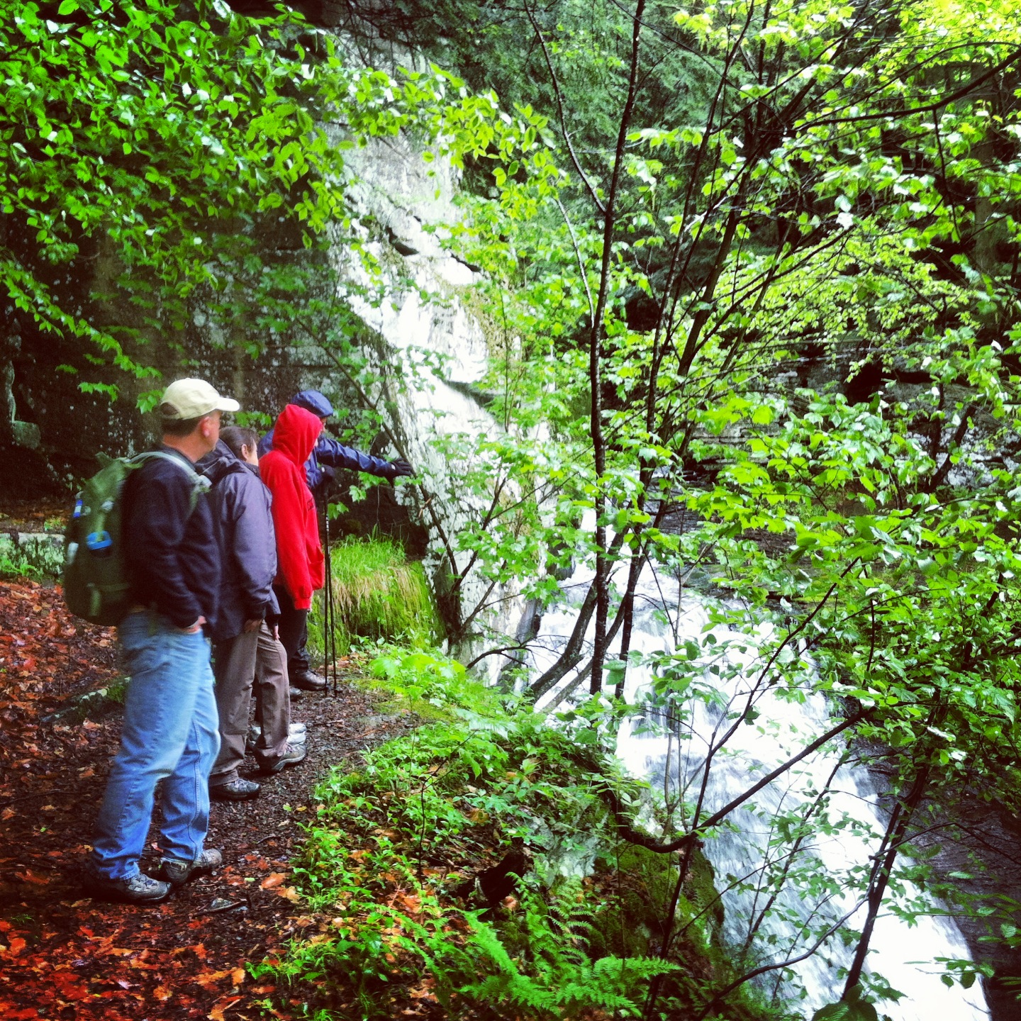 |
| The unmarked side trail leads to an overlook of this waterfall on Russell Brook |
 |
| Trail junction with Mud Pond Trail |
From the trail junction, the trail is well maintained and there are no steep sections to climb. The grade is steady, but gentle and you can make good time as you walk. The trail passes through a generally open forest with a few small drainages passing by. The trail is slightly wet in a few places, but nothing that is too difficult to cross or walk through.
At about nine tenths of a mile into your hike, you reach the southern end and outlet of Trout Pond. There is a small kiosk here and along the southern shore, there is a small beach area.
The trail continues along the eastern shore of Trout Pond and makes its way to the lean-tos located at the northern end of the pond. The trail then passes a small tributary to the pond which has a small structure that is used in the springtime to help stock fish in the pond. Just after that is the first Trout Pond Lean-to, about 200 feet or so back from the shoreline of the lake and set back from the trail on your right.
At this point you also join with the Mud Pond Trail. Following the Mud Pond Trail, you cross the inlet of Trout Pond on a bridge and the second Trout Pond Lean-to is located to your right, slightly up the hill from the main trail. This lean-to is set back further from the lake shore and is located higher up on the hillside.


For a loop hike
For our trip, we returned the way that we came, but if you are interested in a loop hike, at the trail junction in front of the 1st lean-to, you can go left on the Mud Pond Trail, past the second Trout Pond Lean-to and over Cherry Ridge to Mud Pond. Then down from Mud Pond back to the trail junction with the Trout Pond Trail near the trailhead parking area.
For More Information on Hiking and the Outdoors in the Catskill Mountains
Check out our Catskill Mountain Information Page for hikes, advice and planning information.
Need a hiking map for the Catskills? The Trail Conference publishes the Catskills Trails Map Set , which is the best set of maps available for hiking in the Catskills.
  How about a guidebook? Both AMC
 and ADK
 publish Trail Guides to the Catskill Region and the Adventures in the Outdoors Bookstore carries many more books and maps for hiking and exploring the Catskill Mountain region.
Need a hiking map for the Catskills? The Trail Conference publishes the Catskills Trails Map Set


Comments
Post a Comment