Hiking: Updates from Storm's Appalachian Trail Thru-Hike (8/17/16 thru 8/23/16) | New Hampshire - Hanover to Crawford Notch
Appalachian Trail Thru-Hiker Storm (Moe) is now making his way north through Vermont on the Appalachian Trail. He's over 1,760 miles into his Appalachian Trail thru-hike. He started hiking the Appalachian Trail on April 6, 2016 at Springer Mountain in Georgia and is now into his fifth month of his thru hike. Here's a look back at his last several days of hiking in his own words.
(previous journal)
August 17, 2016 - Slack Packing
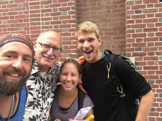 Woke up at Greg's house. Slept ok but for some reason my back was stiff when I got up. I made coffee and had some breakfast. There was a sandwich shop next store to his house and dragon head and I went next store to get a breakfast sandwich. We packed up and Greg took us back to Main Street in Hannover. He takes pictures of every hiker that stays with him and makes a book out of it. This year he has had 83 hikers stay with him so far. He was a great guy and I was so thankful for what he did.
We met Hazel and her husband at the car and put all of our gear in and I took my little day pack. The trail walk through downtown Hannover and then cuts back into the woods by the Dartmouth football fields. We began a climb which was not too steep. The terrain was nice and easy grades with a good trail layout. We were going to go 7 miles and meet Hazels husband for water and snacks. We boogied and made it in no time. We passed Old Spice and Axe and caught back up to so-free.

 We stopped at the car with Steven and loaded back up with Mt Dew. Old spice and Axe passed us and then so-free stopped to chat. Hazel told him to throw his pack in the car and slack with us. He did and we continued on our way. Our last climb was up and over Moose Mt which has an elevation of 2254 feet. We had 6 miles to go back to the car and made it in about two hours.
So-free continued on and we headed to the campground. We stopped at a store so Hazel could get supplies to make spaghetti. We got to the campground and set up our tents. We camped in the same site as Hazel. The campground had a pool which I took advantage of. We had a wonderful meal together and discussed our plan for tomorrow. The plan is 20 miles up and over smarts and cube Mt. It was early to bed about 8:30 as the plan is to leave at 6:30.
August 18, 2016 - Precipitous Drop Off
Woke up today at 5:45. The plan was to leave at 7. Made coffee and had breakfast made by Hazel. She made pancakes and they were delicious. Ever since hiking with Luigi I always carry chocolate chips in my food bag. Hazel made me chocolate chip pancakes. Wohoo. We got in the car and drive the 15 minutes to the trail head.
 We got on trail at about 7:30 and the first climb we had was up Holts Ledge. In the guide book it talked of a precipitous drop off. We didn't know exactly what that meant and thought it was on the descent. We reached the top and had a fantastic view. The trail followed ledges and there was tall grass and shrubs. If you stepped through the grass and or shrubs it was a precipitous drop off to your death. We now knew why he mentioned it.
We descended and came down to the road and met Steven at the car. Steven is Hazel's husband. We loaded up on water, Mt. Dew and snacks. We headed back out with 14 miles remaining. Our next climb was up Smarts mountain which had the typical New Hampshire rock climbs that I knew and love. It's good to be back in New Hampshire. The climb up was steep but the open rock ledges you climb made it interesting. There was a view point that gave you a view of the summit and tower. Ok that's where we need to go. We continued on and reached the summit. We had wood steps and rebar handles. The last mile up the summit was steep, wet rocks and challenges. We stopped at the summit and had snacks. We descended down and stopped at a bridge and a creek. We refilled water and began the climb up Mt Cube. The climbing was very similar to Smarts Mt. Lots of rock ledges and rock hopes. The views from the top were fantastic. We descended down and met Steven.
This second day of slacking was amazing. My body is so thankful for it. We got back to Jacobs Brook campground. I showered, made dinner and relaxed. Hit the sack at about 8:30.
August 19, 2016 - Mount Moosilauke
 In talking about our third and final slack pack with Steven we decided to do our next stretch southbound vs our normal northbound. I was first like I don't know if I can do that but then said hey I'm still walking the same miles. This way we can start the day with Moosilauke instead of end the day with it.
We got on our way and reached the parking area at around 8:30. Steven dropped us off and we began. The climb didn't waste anytime going up. We passed a sign that said only experts should attempt this climb. Please be careful on cascades so there will not be tragic results. The first mile up was steep. We had to use rebar handles and wood block step platforms to get up all the rocks. The trail literally followed a waterfall and cascades up the mountain. We gained 3000 feet in 1.5 miles. It felt so good to be climbing this steep up without a big pack. In what seemed like no time we reached the top. The first mile super steep and then the next two miles were climbs but not too bad.
The last several 100 feet or so was above treeline and the view was simply fantastic. The wind was howling and it was cool. We took pictures and began our descent. Hazel and I took the side trail to the south peak and took pictures. We then headed down the 5 mile descent. We crossed over a few roads and met Steven in the parking lot.
While in the parking lot we saw the hiker yearbook bus and Odie came over to us to make sure he has got our pictures. I can't wait to buy the yearbook. We continued on after saying goodbye to Odie and Steven and tackled Mist Mt which was our last big climb of the day. After we reached the summit of Mist Mt we had a gradual descent all the way to the car.
We passed the 400 mile point which means we have under 400 miles left to walk. It was pretty exciting to pass that point. Tomorrow when we get back to the parking lot and cross the road we will have hit the 1800 mile mark. We popped out of the woods at 6:15 and met Steven.
We headed back to campground for shower. Then off to the laundromat and dinner. We topped off the day with ice cream and I ordered coffee flavored soft serve. A first for me. Tomorrow we head into the Mt Kinsman area.
August 20, 2016 - We Are In It Now
 I woke up at around 7 am in my tent. The plan today was to pack up and meet Trooper and Chris Lovell at the parking area at the trailhead. Doug and his mom were coming to the campground to meet up and help Stephen lighten the load from the 3 of us and our packs and all of their camping stuff. Doug arrived and Hazel broke down and said she's not ready to say goodbye to Stephen yet. My heart broke as I knew exactly how she felt when I had to say goodbye to Jeff that first time in Marion.
So Doug brought Dragon Head, Ninja and I to the parking area. We arrived at 9 and Trooper and Chris were already there. OMG I was so excited to see the two of them. I hadn't seen Chris since December. They were setting up and had doughnuts, soda, Gatorade, fruit, chips, lunch meats and rolls. Dragon Head and Ninja met everyone and they soon started off.
I stayed until 10 and didn't want to get on trail. I wanted to stay all day with them. Doug was slack packing us and I needed to head out before Ninja and DH got too far ahead. Trooper and Chris did trail magic until 3 and had many hikers. Chris loved doing it and got a better understanding of the trail.
I started up the climb from the road and the terrain was tough. There were about 10 ups and down passing Dilly Cliffs and then I climbed up and over Mt Wolf at 3478 feet. The trail was muddy, wet and slippery. At one point I stepped on a board and went to step again and it wasn't wood but a leave. My foot sunk up to my knee in the mud and I thought I was going over my head. I was covered in mud on one leg.

 The trail then descended down to Eliza Brook Shelter which was open bare wet rocks which ended up being a super long slip and slide. I stopped at the shelter to have lunch and Dragon Head and Ninja were there so I caught up. After lunch we began the climb up South Kinsman which was straight up and rock climbs hand over fist. We reached the summit to blue skies and a stiff wind. The views were fantastic and a panorama view. We had a short saddle walk to North Kinsman and not a very good view. We then had a very steep decent down to lonesome lake hut. Lonesome Lake had fantastic views of the Franconia Ridge.
We carried on and made our way down to route 3. We passed under both bridges and left the trail to climb up to the road. After a bit of confusion to where Doug was we found the car and brought Dragon Head and Ninja to their motel in North Woodstock. We then headed to Whitefield to the only motel room available in all of the White Mountains. I was exhausted after doing 16 miles and that was without a pack. I would have had to broken that into two days with a pack. We had dinner in Lancaster and I had a fantastic steak and cheese. Then we headed back to the motel where I immediately passed out.
August 21, 2016 - Franconia Ridge Trail
Woke up at Barron Brook Inn. Doug and I shared a room and Jeff's mom had her own. The reservation got screwed up online so they had to get a room at a different motel but got a free room out of it. I got up and grabbed a cup of coffee before jumping in the shower. Then packed my bag and went through my food bag to ensure I had enough food to make it to Crawford Notch.
I was thinking our little trail family got scattered to the crosswinds. Hazel was behind as she couldn't say goodbye to Stephen just yet and didn't get onto the trail until around 12:30. Ninja and Dragon Head had made a reservation at a motel in Woodstock but I didn't jump in with them on it as I wasn't sure what family was going to do. Good thing as with us slack packing we didn't make it to the road on route 3 until about 7. We dropped Ninja and Dragon Head off at the motel and had to drive to Whitfield to the only motel with a room available. So all of us started at different locations and times today.
We checked out of the motel and headed on route 2 towards Lyndonville, Vermont to meet my old college roommate for breakfast. We went to the Miss Lyndonville Diner for breakfast and it was fantastic. Heather, Meghan and Andy met up with us and we had a good time catching up.
We left about 11 and headed down I-91 to I-93 back to Franconia Notch. I got dropped off on the side of the highway and said goodbye to Doug and mom and started back into the woods. The first part of the day was a steady almost steep climb up Liberty Springs trail for 2.9 miles. Then I merged onto the Franconia Ridge trail which went up and over Haystack, Lincoln and Lafayette peaks.
Once you summit Haystack you are above treeline and the views were amazing. The visibility was clear and the scenery beautiful. The climbs up each peak were only a few hundred feet and each peak you gradually gain more elevation. Once on top of Lafayette I noticed that the clouds were moving in. I knew the rain was coming and wanted to boogie to make it to Garfield Shelter before the rain hit. Dragon head had said he was going to try and make it there today. I descended down Lafayette and the wind began to howl and really blew me around. I looked at radar and saw the rain close. I was running out of time and got to Garfield Pond and saw some stealth campsites and quickly set up my tent. I had enough time to eat, brush my teeth and put up my food bag before the storm hit. I'm snuggled in my tent in my bag as the wind howls and the rain falls.
August 22, 2016 - The Storm
What a wet and wild night. The storm really started to ramp up around 9pm and lasted most of the night. It poured and poured. Luckily I stayed dry except for some mist that blew into the tent. The temperature plummeted and hovered somewhere around 45. I was snuggled in my sleeping and was content.

I woke up to a baby crying. Wait is that really a baby crying or is it a child crying. I unzipped my rain fly and stuck my head out into the fog to see and didn't see anything. I went back to bed and heard it again. This time I got up the use the "gentleman's lounge and saw a girl mid 20's sitting on a log but didn't hear crying. Hmm. I began packing up and started on my way but passed the girl and a guy. I asked them if they were ok and found out that their tent poles were left at the last place they camped so they had to sleep out in the rain. They looked pretty miserable and she was crying from being so cold. I suggested they get moving to warm up and not sit too long in one place. They were packing up when I left and I began my ascent of Mt. Garfield.
With all the rain last light the trail was a creek. Lots of water running down the trail. It was in the mid 40's and winds gusting to 50-60 mph. I reached the summit of Garfield in pea soup fog and high winds. Didn't stay too long and then I began my descent down Garfield stopping at Garfield Shelter to make some chicken noodle soup. I relaxed and stayed for about a half hour and then pushed on.
I filled up my water at the creek at the junction of the trail and the side trail to the shelter. I saw the couple who slept out in the rain coming down from the summit of Garfield and they were moving. They didn't look happy but at least no longer looking like hypothermia. I pushed on and continued my descent down. The trail looked like it crossed over the creek but then there was no path. I looked down the creek and there were the white blazes which went straight down. You got to be kidding me. I think normally without the heavy rain the creek stays under all the boulders. Today however it was pouring into my boots on top of my head as I weaved my way down holding onto trees, roots and anything I could to avoid slipping. I was pretty wet.
The trail leveled out with only small ups and downs. I was getting pretty cold and arrived at Galehead Hut. I went inside to warm up and met Pharmacist and Sneaky Pete. They were having soup and coffee and I joined them. I joined them and we talked about our plans for the day. It was raw and even chilly in the hut. They were calling for wind gusts up to 85mph on the peaks today. Pharmacist was talking about staying at the hut and seeing about getting work for stay. Sneaky Pete and I were going to move to Zealand Notch Hut. I packed up and headed out at around 2 to try to get to the hut for 5.
I began my ascent up South Twin Mt. It was straight up at a steep pitch for a mile. When I reached the top the wind was so strong I could barely stand up. It kept blowing me over. I began the descent down and Sneaky Pete caught up to me. We started hiking together the rest of the way to the hut. We went up and over Guyot Mt and Zealand Mt. We came to Zeacliff and had a fantastic view of the notch and valley below. When we arrived to Zeacliff the sun came out and the skies cleared. Finally!!
We made the final ascent and arrived at the hut. Sneaky Pete is a fast hiker and I had fun trying to keep up with him. We asked at the hut if they had any work for stay left. Sneaky Pete was more interested in work for food more than staying over night. They told us they could use one of us and he told me to take it. They were getting ready for dinner and asked us to wait outside. Sneaky Pete and I sat on the benches in front of the hut taking in the views.
Two south bounders who were on the other side of the hut came over and said hi. They were doing work for stay as well. One of the hut workers brought out leftovers for sneaky Pete who was gonna be moving on tonight. After he ate he headed out to find a stealth campsite down the trail. At 7:45 they invited us in for left overs. They cooked us some bow ties with sauce as there were not a ton of leftovers. There was salad, rice, fresh bread, pasta, corn chowder and chocolate chip cookies. Yum!!
After dinner the two south bounders had some work to do but my work wouldn't be until the morning as I was in no rush to go anywhere. I kinda felt under the weather and was trying to relax and enjoy myself. I read for awhile while the two south bounders cleaned the stove. At 9:30 they shut the hut lights off and I went out to look at the stars briefly. We pushed some of the tables over and made room for us to roll out our mats and sleeping bags to sleep on the dinning room floor. I zonked out almost immediately.
August 23, 2016 - Zealand Notch
I had the best night sleep on the dining room floor last night. We got up at 6 as the Croo were beginning to make breakfast for the guests. I packed up and brought my stuff out on the deck and sat and had a cup of coffee.

Jeff had said possibly he would drive up and come find me in Crawford Notch but unfortunately I hadn't cell service to text him anything. The guests finished their breakfast around 8:30 and the Croo had me come in for leftovers. Corn bread, oatmeal, dried apricots, and sliced peaches. Delicious!!
I sat and wrote my trail journals for the next day while drinking more coffee. I finished and the dining room cleared out so I asked what they needed me to do for my work for stay. They asked if I could sweep out both bunk rooms and the dining room floor. No problem that's a piece of cake I got this. It only took me about 40 minutes to sweep all three spaces. Once I was done I decided to leave my pack and hike up to Zeacliff to see if I could get a text out to Jeff. I didn't want him driving up to meet me when I was no where near Crawford Notch. Luckily I had enough cell service to get the text out no problem.
I was hoping with my delay this morning Hazel would catch up to me. I told myself to be on trail by noon at the latest. When I got back to Zealand Hut I got my gear on and headed out. I had a small climb down from the hut to the side trail that leads you to the road that most people walk into the hut from. I continued on into the notch and was amazed at the beauty and the fact that the trail was flat for 6 miles. The trail wanders between Zealand Notch and then passes Ethan pond before descending down into Crawford Notch. I stopped at Ethan Pond to have a snack and to check out the view. I continued on and descended down to the road where I walked a mile up the road to the Wiley House to get food. I had a turkey sandwich, bag of chips, 2 cokes and a Powerade. I had been battling a stomach ache most of the day and I suspect it was from the curry sauce I had at Zealand Notch. I was hoping that this food would help alleviate that problem. Well unfortunately the stomach ache continued while I made the big climb up Mt. Webster. My plan was to get to the Webster Cliffs and to stealth camp. The climb up was steep but I took it slow and arrived at the Webster Cliffs. I found a great place to camp and set up. I made dinner and watched the sunset. I was passed out before I knew it.
(next journal)
--------
You can also follow him on his Facebook Page, Moe Hikes the Appalachian Trail
Storm is also working to raise money for charity as he hikes the Appalachian Trail. He currently has a GoFundMe campaign that is supporting the work of the Catskill Center to protect and preserve the Catskills and the Catskill Park, where Storm lives, enjoys the outdoors and volunteers!
Read all of Storm's posts on Adventures in the Outdoors.
You can visit the National Park Service's Appalachian Trail Park Page, which features a link to the AT brochure and map. Guides and maps are produced and sold for the AT as it passes through each State between Georgia and Maine. There are several books including the Thru-Hike Planner, the AT Guidebook, the AT Thru Hiker Companion and the Data Book to name just a few that can help hikers who are planning on hiking the entire AT or sections of it. We also maintain a section for Appalachian Trail Guides, Maps and Books at on Adventures in the Outdoors Online Shop.


(previous journal)
August 17, 2016 - Slack Packing

We met Hazel and her husband at the car and put all of our gear in and I took my little day pack. The trail walk through downtown Hannover and then cuts back into the woods by the Dartmouth football fields. We began a climb which was not too steep. The terrain was nice and easy grades with a good trail layout. We were going to go 7 miles and meet Hazels husband for water and snacks. We boogied and made it in no time. We passed Old Spice and Axe and caught back up to so-free.

So-free continued on and we headed to the campground. We stopped at a store so Hazel could get supplies to make spaghetti. We got to the campground and set up our tents. We camped in the same site as Hazel. The campground had a pool which I took advantage of. We had a wonderful meal together and discussed our plan for tomorrow. The plan is 20 miles up and over smarts and cube Mt. It was early to bed about 8:30 as the plan is to leave at 6:30.
August 18, 2016 - Precipitous Drop Off
Woke up today at 5:45. The plan was to leave at 7. Made coffee and had breakfast made by Hazel. She made pancakes and they were delicious. Ever since hiking with Luigi I always carry chocolate chips in my food bag. Hazel made me chocolate chip pancakes. Wohoo. We got in the car and drive the 15 minutes to the trail head.

We descended and came down to the road and met Steven at the car. Steven is Hazel's husband. We loaded up on water, Mt. Dew and snacks. We headed back out with 14 miles remaining. Our next climb was up Smarts mountain which had the typical New Hampshire rock climbs that I knew and love. It's good to be back in New Hampshire. The climb up was steep but the open rock ledges you climb made it interesting. There was a view point that gave you a view of the summit and tower. Ok that's where we need to go. We continued on and reached the summit. We had wood steps and rebar handles. The last mile up the summit was steep, wet rocks and challenges. We stopped at the summit and had snacks. We descended down and stopped at a bridge and a creek. We refilled water and began the climb up Mt Cube. The climbing was very similar to Smarts Mt. Lots of rock ledges and rock hopes. The views from the top were fantastic. We descended down and met Steven.
This second day of slacking was amazing. My body is so thankful for it. We got back to Jacobs Brook campground. I showered, made dinner and relaxed. Hit the sack at about 8:30.
August 19, 2016 - Mount Moosilauke

We got on our way and reached the parking area at around 8:30. Steven dropped us off and we began. The climb didn't waste anytime going up. We passed a sign that said only experts should attempt this climb. Please be careful on cascades so there will not be tragic results. The first mile up was steep. We had to use rebar handles and wood block step platforms to get up all the rocks. The trail literally followed a waterfall and cascades up the mountain. We gained 3000 feet in 1.5 miles. It felt so good to be climbing this steep up without a big pack. In what seemed like no time we reached the top. The first mile super steep and then the next two miles were climbs but not too bad.
The last several 100 feet or so was above treeline and the view was simply fantastic. The wind was howling and it was cool. We took pictures and began our descent. Hazel and I took the side trail to the south peak and took pictures. We then headed down the 5 mile descent. We crossed over a few roads and met Steven in the parking lot.
While in the parking lot we saw the hiker yearbook bus and Odie came over to us to make sure he has got our pictures. I can't wait to buy the yearbook. We continued on after saying goodbye to Odie and Steven and tackled Mist Mt which was our last big climb of the day. After we reached the summit of Mist Mt we had a gradual descent all the way to the car.
We passed the 400 mile point which means we have under 400 miles left to walk. It was pretty exciting to pass that point. Tomorrow when we get back to the parking lot and cross the road we will have hit the 1800 mile mark. We popped out of the woods at 6:15 and met Steven.
We headed back to campground for shower. Then off to the laundromat and dinner. We topped off the day with ice cream and I ordered coffee flavored soft serve. A first for me. Tomorrow we head into the Mt Kinsman area.
August 20, 2016 - We Are In It Now

So Doug brought Dragon Head, Ninja and I to the parking area. We arrived at 9 and Trooper and Chris were already there. OMG I was so excited to see the two of them. I hadn't seen Chris since December. They were setting up and had doughnuts, soda, Gatorade, fruit, chips, lunch meats and rolls. Dragon Head and Ninja met everyone and they soon started off.
I stayed until 10 and didn't want to get on trail. I wanted to stay all day with them. Doug was slack packing us and I needed to head out before Ninja and DH got too far ahead. Trooper and Chris did trail magic until 3 and had many hikers. Chris loved doing it and got a better understanding of the trail.
I started up the climb from the road and the terrain was tough. There were about 10 ups and down passing Dilly Cliffs and then I climbed up and over Mt Wolf at 3478 feet. The trail was muddy, wet and slippery. At one point I stepped on a board and went to step again and it wasn't wood but a leave. My foot sunk up to my knee in the mud and I thought I was going over my head. I was covered in mud on one leg.

We carried on and made our way down to route 3. We passed under both bridges and left the trail to climb up to the road. After a bit of confusion to where Doug was we found the car and brought Dragon Head and Ninja to their motel in North Woodstock. We then headed to Whitefield to the only motel room available in all of the White Mountains. I was exhausted after doing 16 miles and that was without a pack. I would have had to broken that into two days with a pack. We had dinner in Lancaster and I had a fantastic steak and cheese. Then we headed back to the motel where I immediately passed out.
August 21, 2016 - Franconia Ridge Trail
Woke up at Barron Brook Inn. Doug and I shared a room and Jeff's mom had her own. The reservation got screwed up online so they had to get a room at a different motel but got a free room out of it. I got up and grabbed a cup of coffee before jumping in the shower. Then packed my bag and went through my food bag to ensure I had enough food to make it to Crawford Notch.
I was thinking our little trail family got scattered to the crosswinds. Hazel was behind as she couldn't say goodbye to Stephen just yet and didn't get onto the trail until around 12:30. Ninja and Dragon Head had made a reservation at a motel in Woodstock but I didn't jump in with them on it as I wasn't sure what family was going to do. Good thing as with us slack packing we didn't make it to the road on route 3 until about 7. We dropped Ninja and Dragon Head off at the motel and had to drive to Whitfield to the only motel with a room available. So all of us started at different locations and times today.
We checked out of the motel and headed on route 2 towards Lyndonville, Vermont to meet my old college roommate for breakfast. We went to the Miss Lyndonville Diner for breakfast and it was fantastic. Heather, Meghan and Andy met up with us and we had a good time catching up.
We left about 11 and headed down I-91 to I-93 back to Franconia Notch. I got dropped off on the side of the highway and said goodbye to Doug and mom and started back into the woods. The first part of the day was a steady almost steep climb up Liberty Springs trail for 2.9 miles. Then I merged onto the Franconia Ridge trail which went up and over Haystack, Lincoln and Lafayette peaks.
Once you summit Haystack you are above treeline and the views were amazing. The visibility was clear and the scenery beautiful. The climbs up each peak were only a few hundred feet and each peak you gradually gain more elevation. Once on top of Lafayette I noticed that the clouds were moving in. I knew the rain was coming and wanted to boogie to make it to Garfield Shelter before the rain hit. Dragon head had said he was going to try and make it there today. I descended down Lafayette and the wind began to howl and really blew me around. I looked at radar and saw the rain close. I was running out of time and got to Garfield Pond and saw some stealth campsites and quickly set up my tent. I had enough time to eat, brush my teeth and put up my food bag before the storm hit. I'm snuggled in my tent in my bag as the wind howls and the rain falls.
August 22, 2016 - The Storm
What a wet and wild night. The storm really started to ramp up around 9pm and lasted most of the night. It poured and poured. Luckily I stayed dry except for some mist that blew into the tent. The temperature plummeted and hovered somewhere around 45. I was snuggled in my sleeping and was content.

I woke up to a baby crying. Wait is that really a baby crying or is it a child crying. I unzipped my rain fly and stuck my head out into the fog to see and didn't see anything. I went back to bed and heard it again. This time I got up the use the "gentleman's lounge and saw a girl mid 20's sitting on a log but didn't hear crying. Hmm. I began packing up and started on my way but passed the girl and a guy. I asked them if they were ok and found out that their tent poles were left at the last place they camped so they had to sleep out in the rain. They looked pretty miserable and she was crying from being so cold. I suggested they get moving to warm up and not sit too long in one place. They were packing up when I left and I began my ascent of Mt. Garfield.
With all the rain last light the trail was a creek. Lots of water running down the trail. It was in the mid 40's and winds gusting to 50-60 mph. I reached the summit of Garfield in pea soup fog and high winds. Didn't stay too long and then I began my descent down Garfield stopping at Garfield Shelter to make some chicken noodle soup. I relaxed and stayed for about a half hour and then pushed on.
I filled up my water at the creek at the junction of the trail and the side trail to the shelter. I saw the couple who slept out in the rain coming down from the summit of Garfield and they were moving. They didn't look happy but at least no longer looking like hypothermia. I pushed on and continued my descent down. The trail looked like it crossed over the creek but then there was no path. I looked down the creek and there were the white blazes which went straight down. You got to be kidding me. I think normally without the heavy rain the creek stays under all the boulders. Today however it was pouring into my boots on top of my head as I weaved my way down holding onto trees, roots and anything I could to avoid slipping. I was pretty wet.
The trail leveled out with only small ups and downs. I was getting pretty cold and arrived at Galehead Hut. I went inside to warm up and met Pharmacist and Sneaky Pete. They were having soup and coffee and I joined them. I joined them and we talked about our plans for the day. It was raw and even chilly in the hut. They were calling for wind gusts up to 85mph on the peaks today. Pharmacist was talking about staying at the hut and seeing about getting work for stay. Sneaky Pete and I were going to move to Zealand Notch Hut. I packed up and headed out at around 2 to try to get to the hut for 5.
I began my ascent up South Twin Mt. It was straight up at a steep pitch for a mile. When I reached the top the wind was so strong I could barely stand up. It kept blowing me over. I began the descent down and Sneaky Pete caught up to me. We started hiking together the rest of the way to the hut. We went up and over Guyot Mt and Zealand Mt. We came to Zeacliff and had a fantastic view of the notch and valley below. When we arrived to Zeacliff the sun came out and the skies cleared. Finally!!
We made the final ascent and arrived at the hut. Sneaky Pete is a fast hiker and I had fun trying to keep up with him. We asked at the hut if they had any work for stay left. Sneaky Pete was more interested in work for food more than staying over night. They told us they could use one of us and he told me to take it. They were getting ready for dinner and asked us to wait outside. Sneaky Pete and I sat on the benches in front of the hut taking in the views.
Two south bounders who were on the other side of the hut came over and said hi. They were doing work for stay as well. One of the hut workers brought out leftovers for sneaky Pete who was gonna be moving on tonight. After he ate he headed out to find a stealth campsite down the trail. At 7:45 they invited us in for left overs. They cooked us some bow ties with sauce as there were not a ton of leftovers. There was salad, rice, fresh bread, pasta, corn chowder and chocolate chip cookies. Yum!!
After dinner the two south bounders had some work to do but my work wouldn't be until the morning as I was in no rush to go anywhere. I kinda felt under the weather and was trying to relax and enjoy myself. I read for awhile while the two south bounders cleaned the stove. At 9:30 they shut the hut lights off and I went out to look at the stars briefly. We pushed some of the tables over and made room for us to roll out our mats and sleeping bags to sleep on the dinning room floor. I zonked out almost immediately.
August 23, 2016 - Zealand Notch
I had the best night sleep on the dining room floor last night. We got up at 6 as the Croo were beginning to make breakfast for the guests. I packed up and brought my stuff out on the deck and sat and had a cup of coffee.

Jeff had said possibly he would drive up and come find me in Crawford Notch but unfortunately I hadn't cell service to text him anything. The guests finished their breakfast around 8:30 and the Croo had me come in for leftovers. Corn bread, oatmeal, dried apricots, and sliced peaches. Delicious!!
I sat and wrote my trail journals for the next day while drinking more coffee. I finished and the dining room cleared out so I asked what they needed me to do for my work for stay. They asked if I could sweep out both bunk rooms and the dining room floor. No problem that's a piece of cake I got this. It only took me about 40 minutes to sweep all three spaces. Once I was done I decided to leave my pack and hike up to Zeacliff to see if I could get a text out to Jeff. I didn't want him driving up to meet me when I was no where near Crawford Notch. Luckily I had enough cell service to get the text out no problem.
I was hoping with my delay this morning Hazel would catch up to me. I told myself to be on trail by noon at the latest. When I got back to Zealand Hut I got my gear on and headed out. I had a small climb down from the hut to the side trail that leads you to the road that most people walk into the hut from. I continued on into the notch and was amazed at the beauty and the fact that the trail was flat for 6 miles. The trail wanders between Zealand Notch and then passes Ethan pond before descending down into Crawford Notch. I stopped at Ethan Pond to have a snack and to check out the view. I continued on and descended down to the road where I walked a mile up the road to the Wiley House to get food. I had a turkey sandwich, bag of chips, 2 cokes and a Powerade. I had been battling a stomach ache most of the day and I suspect it was from the curry sauce I had at Zealand Notch. I was hoping that this food would help alleviate that problem. Well unfortunately the stomach ache continued while I made the big climb up Mt. Webster. My plan was to get to the Webster Cliffs and to stealth camp. The climb up was steep but I took it slow and arrived at the Webster Cliffs. I found a great place to camp and set up. I made dinner and watched the sunset. I was passed out before I knew it.
(next journal)
--------
Storm is posting regular updates from the AT on his Trail Journal
You can also follow him on his Facebook Page, Moe Hikes the Appalachian Trail
Storm is also working to raise money for charity as he hikes the Appalachian Trail. He currently has a GoFundMe campaign that is supporting the work of the Catskill Center to protect and preserve the Catskills and the Catskill Park, where Storm lives, enjoys the outdoors and volunteers!
Read all of Storm's posts on Adventures in the Outdoors.
For more information about the Appalachian Trail


Comments
Post a Comment